On this page
- In Brief
- Getting to North Bali at a Glance
- A Private Driver Is the Easiest Way North
- A Rental Car Suits Drivers Comfortable with Balinese Roads
- A Scooter Is Best Rented Once You Are in the North
- Public Transport Is the Cheapest Way and the Slowest
- Three Roads Cross the Mountains, and a Coast Road Comes Round from the East
- Getting Around Once You're There: a Driver for Day Trips, a Scooter for Short Hops
- Practical Notes
- FAQ
- Sources
In Brief
How to get to north Bali has one answer: by road, over the central mountains. From Ngurah Rai airport or anywhere in the south, Lovina is roughly a three-hour drive up through the highlands and past the Bedugul lakes. There is no train on the island (why Bali has no railway) and no direct domestic flight.
You have four options: a private driver, a rental car you drive yourself, a scooter if you ride well, or slow public transport. If you arrive with luggage after a long flight, a private driver is the sensible choice. It also lets you turn the drive into the first half-day of the trip.
Coming overland from Java, the ferry lands at Gilimanuk in the far west, and the north coast road runs from there to Pemuteran and Lovina. See the Java to Bali ferry. For the wider picture of the region, start with the complete north Bali guide.
Getting to North Bali at a Glance
- How: by road over the central mountains. No train and no direct domestic flight
- Drive time: roughly three hours from Ngurah Rai airport to Lovina in good conditions, more in rain or traffic
- Common route: the Bedugul road, past the lakes of Beratan, Buyan and Tamblingan
- Other crossings: Pupuan to Seririt in the west, Kintamani to Kubutambahan in the east
- Roadworks: shortcut points 9 and 10 at Gitgit are under construction
- From Java: the ferry to Gilimanuk, then the north coast road
| Option | Who it suits | Know before you choose |
|---|---|---|
| Private driver | Arrivals with luggage after a long flight | Agree the rate, and what it includes, before you set off |
| Rental car | Drivers comfortable with Balinese roads | You need an International Driving Permit and insurance that covers you |
| Scooter | Confident riders, once they are in the north | The mountain crossing is for experienced riders only |
| Public transport | Budget travellers with time and patience | Changes, waits and no direct route from the airport |
A Private Driver Is the Easiest Way North
A private driver is the easiest way north, and many visitors end up choosing one.
You are met at the airport and your bags go in the car. You can sleep or look out of the window while someone who drives these switchbacks every week handles the road.
The stops are the real advantage. The drive passes some of the best scenery on the island, and a good driver treats it as part of the journey. You can break the climb at:
- the Bedugul lakes
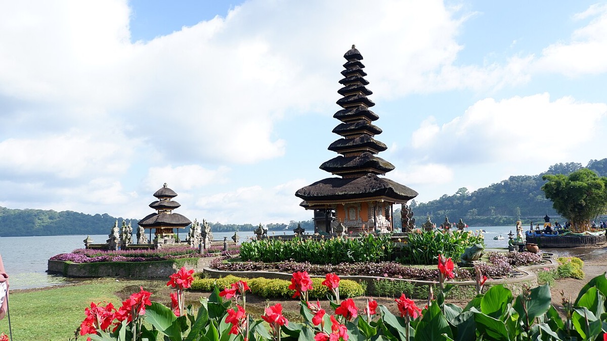
- the lakeside temple of Ulun Danu Beratan
- a strawberry stall in the highlands
- a waterfall on the way down to the coast
Choose a One-Way Transfer or a Day Rate
Drivers are booked by the day or for a one-way transfer. A one-way run to Lovina is straightforward. A day rate buys the same car for sightseeing stops along the way, and it is the better value if you want to slow down.
Both rates shift with fuel, season and how far west you are headed. Agree the figure with the driver or your villa before you set off. Ask what the day rate includes. Fuel, parking and the driver's meal are sometimes in it and sometimes not.
Book Through the Place You Are Staying
The simplest way to book a driver is through your accommodation. Many villas and guesthouses in the north have a driver they trust and will arrange the airport run.
The full breakdown of rates, how the day works and what to expect is in hiring a private driver in north Bali.
A Rental Car Suits Drivers Comfortable with Balinese Roads
Renting a car gives you freedom and your own pace once you are in the north.
A small car handles the mountain crossing fine. Your own wheels also make the spread-out north easy to explore, where the waterfalls, hot springs and beaches sit far apart.
The driving is the caveat. Traffic near the airport is dense and fast, and the mountain road is a long series of tight switchbacks. Local road habits take some adjusting to as well.
Doing all of that on day one, jet-lagged and on an unfamiliar side of the road, is a lot to take on. Many people who rent a car still hire a driver for the first transfer up and pick up the rental in the north. It is a good compromise.
Before you take the keys:
- Permit: you need an International Driving Permit to drive legally
- Rate: rental rates depend on the car and the season, so agree the daily rate first
- Insurance: read what the rental insurance actually covers
- Photos: photograph the car from every angle at pickup
- Fuel: it is cheap, but stations thin out in the highlands, so fill up before the climb
A Scooter Is Best Rented Once You Are in the North
For confident riders, a scooter is the cheapest and most flexible way to get around the north.
On the quiet coast road it is a pleasant ride. It is the local way to move between villages, beaches and warungs, and once you are settled in Lovina it is hard to beat. The licence you need is set out in driving licence in Bali.
Riding the full crossing from the south is a different matter. The mountain road is three hours of winding climbs and descents, shared with trucks and tour buses, and luggage strapped on makes it harder. It is for experienced riders only, and even then it is slow and tiring.
Many people who want a scooter in the north rent one when they arrive, instead of riding it up from the airport.
Three checks apply wherever you ride:
-
Helmet and pace. Wear a real helmet and ride within your limit. Take the mountain weather seriously, because rain turns the switchbacks slick fast.
-
Insurance. Confirm your travel insurance covers motorbikes. Many policies do not unless you hold the correct licence.
-
Rate. Scooter hire is priced by the day and is usually cheaper by the week. Your villa or the rental shop will quote the current rate.
Public Transport Is the Cheapest Way and the Slowest
Public transport to the north exists, and it is the cheapest way to go. It is also slow and awkward with bags, so it suits budget travellers with time and patience.
Public buses run to Singaraja, the north's main town. There you change for a bemo, one of the local minibuses, out to Lovina.
The trip works and costs very little. It also means multiple changes, long waits and squeezing luggage into a crowded van. There is no direct, comfortable public route from the airport to the north coast.
If your time matters more than your money, a private driver is the better call.
Three Roads Cross the Mountains, and a Coast Road Comes Round from the East
The roads are slow and winding, built for the terrain. Three hours is the honest figure in good conditions, and rain or traffic adds to it.
The Bedugul Road Is the Common Route
The Bedugul road is the central climb from the south. It runs up through Bedugul, past the highland lakes of Beratan, Buyan and Tamblingan, then down the long descent to Lovina.
It is the scenic route, with the lakeside temple, cool mountain air and the highland markets. The waterfall cluster around Gitgit is on the way down.
Most transfers to Lovina and the central north use this road. It is the route to choose if you want the drive to earn its three hours.
For Pemuteran and the far northwest, drivers often cross the mountains first and then run along the north coast road, with no doubling back.
The Mengwitani to Singaraja Shortcut Is Partly Open
Anyone who last drove the Bedugul road a few years ago will find the northern descent changed.
Since 2018 the Bali provincial government and the national public works ministry have been rebuilding the worst of the mountain road, from Mengwitani in the south to Singaraja. The work is a series of "shortcuts", numbered as points along the route. Each one is a set of new cuttings, bridges and gentler curves that bypass the old hairpins.
Locally the whole project is simply called the shortcut.
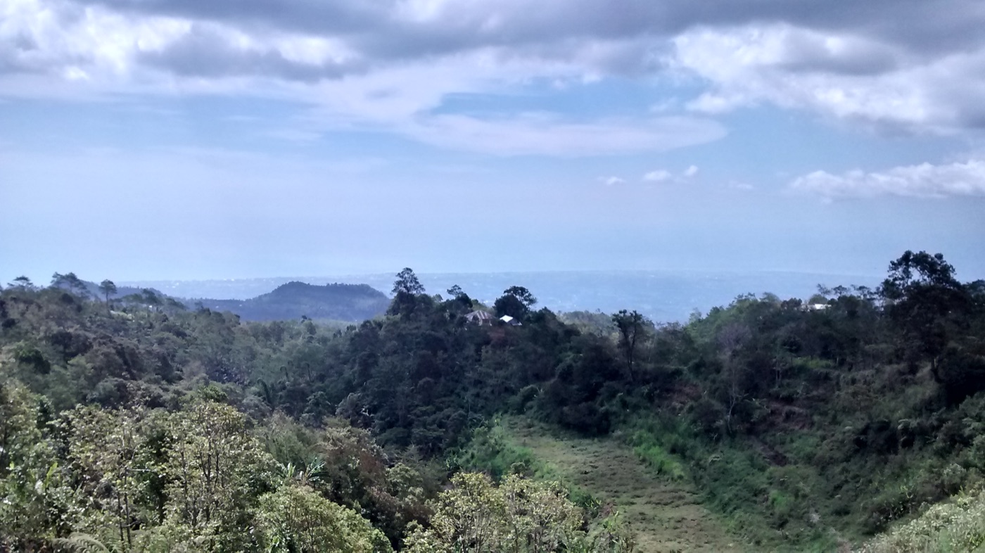 Looking north from Wanagiri, where the road starts its descent toward the coast. Photo: F-GSPY / Wikimedia Commons (CC BY 3.0)
Where it stands, going by the public works ministry, Buleleng Regency and the provincial government:
- Finished and in use: points 3 and 4 on the Tabanan side near Bedugul, and points 5 to 8 on the Buleleng side of the descent, with 7 built as 7A, 7B and 7C. President Joko Widodo formally opened them in 2023, as the public works ministry published at the time. The Directorate General of Highways then continued with sections 7D and 7E.
- Under construction: points 9 and 10, in Gitgit village in Sukasada district. The governor broke ground on them in January 2026, and had earlier described a two-stage, multi-year build because of the difficult terrain.
- Still to come: the remaining points up to 12, which the province intends to complete in stages. Treat any completion date as a plan.
When the whole route is done, the highways directorate says, the sharp bends on the Denpasar to Singaraja road fall from 58 to 21. The steepest gradient falls from 27 percent to 10 percent, which makes the road safer for the trucks and buses that use it.
The governor has gone further and pictured a subsidised public bus from Singaraja reaching Denpasar in about an hour and a half, once every point is open. For now, that is a plan.
For your trip today, two things matter:
- The finished sections are far gentler. That helps anyone prone to car sickness and makes the descent less tiring on a scooter.
- The construction zone sits at Gitgit, on the main road. Expect slow stretches or lane closures around the Gitgit waterfall stops while the work continues.
Plan on the three-hour figure until the last points open. Ask your driver on the day, since traffic management at the works changes as the build moves. The Gitgit waterfall guide covers the stop itself.
The Western Road via Pupuan Comes Down at Seririt
The western crossing climbs through Pupuan, a coffee-growing highland district of Tabanan. It comes down through Busungbiu to the coast at Seririt, west of Lovina. That puts you closer to Pemuteran and the far northwest than the Bedugul road does.
On the Buleleng side the road passes the Kekeran rice terraces in Busungbiu, where you can see working subak fields from the car. The subak guide explains what you are looking at.
The drive time depends on where in the south you start, so ask your driver to compare it with the Bedugul road on the day.
The Eastern Road via Kintamani Comes Down near Kubutambahan
From Ubud or the Kintamani highlands, a third road crosses the island's eastern shoulder past the Batur caldera. It comes down to the north coast near Kubutambahan, east of Singaraja.
It makes sense if you are already in the east or the centre. It also suits a trip to the carved temples at Kubutambahan and Sangsit, covered in the north Bali temples guide, or to the quiet coast around Tejakula.
The Kintamani end of this road is exposed to storm damage. Part of the Penelokan to Kintamani road gave way in heavy rain and ran on alternating one-way traffic while it was secured. Check conditions with a local driver before you set off, and do not trust a mapping app for this.
The Coast Road Comes Round from Amed and the East
The eastern way runs up the coast through Singaraja. It is the line to take if you are headed to the eastern end of the north, or coming round from Amed and the east.
It trades the highland scenery for coastal road. For most airport arrivals headed to Lovina it is the longer way around.
Getting Around Once You're There: a Driver for Day Trips, a Scooter for Short Hops
The north is spread out.
Lovina itself is a string of villages along the coast road. The waterfalls, hot springs and highlands sit anywhere from twenty minutes to an hour and a half away. Distances are short on the map and longer on the ground, because the roads wind.
For day trips, a hired driver is the easy answer. The same driver who brought you up will usually run you to Sekumpul, Banjar or Munduk for a day rate.
For short hops between your villa, the beach and dinner, a scooter is cheap and well suited. Plenty of visitors combine the two, with a driver for the big inland days and a scooter for everything close to home.
There are no apps with reliable car coverage in the north, so most things are arranged in person or through your villa. See the Lovina area guide for how the villages line up along the coast.
Practical Notes
The details below change. Confirm current rates and conditions locally before you go.
- Drive from the airport: roughly three hours over the mountains. Allow more in rain or heavy traffic
- Shortcut roadworks: points 9 and 10 at Gitgit are under construction. Expect slow stretches near the Gitgit waterfalls, and ask a driver for the current state
- Private driver: quoted as a one-way transfer or as a day rate. The day rate with stops costs more and is the better value if you want to sightsee. Agree it, and what it includes, before setting off
- Car rental: priced per day by car type. You need an International Driving Permit and insurance that actually covers you
- Scooter hire: priced per day and cheaper by the week. Ride the mountain crossing only if you are experienced
- Public transport: a public bus to Singaraja, then a bemo out to Lovina. Cheap, but slow, with changes and waits
- Fuel: cheap, but fill up before the mountain climb, as stations thin out in the highlands
- Cash: ATMs in Lovina and Singaraja. Carry cash for drivers, fuel stops and small fares
FAQ
How do you get to north Bali from the airport? By road over the central mountains, roughly a three-hour drive from Ngurah Rai airport past the Bedugul lakes to Lovina. A private driver is the simplest option and lets you stop at the lakes or a waterfall on the way up. There is no train and no direct flight to the north.
Is the new shortcut road to north Bali finished? Partly. The Mengwitani to Singaraja shortcut replaces the old hairpins on the Bedugul road in numbered sections. Points 3 to 8 are finished and in use, points 9 and 10 at Gitgit are under construction, and the remaining points are still to come. Until it is all open, allow about three hours from the airport to Lovina.
How long is the drive to Lovina? About three hours in good conditions, up through the highlands and down to the coast. Rain, traffic or sightseeing stops add to it, so allow extra time and treat the drive as part of the trip.
Is it better to hire a driver or rent a car in north Bali? For many visitors a private driver is better for the transfer up, since the mountain road is winding and the stops are half the pleasure. A rental car suits confident drivers who want freedom once they arrive. A common middle path is a driver for the journey north and a scooter or rental once you are settled.
Can you take public transport to north Bali? Yes, but it is slow. The public bus to Singaraja and the local bemos out to Lovina cost very little but mean changes and waits. There is no direct, comfortable public route from the airport, so a driver is the better call if time matters.
How do you get around north Bali? A hired driver for inland day trips to the waterfalls, hot springs and highlands, and a scooter for short hops between your villa, the beach and dinner. The region is spread out and the roads wind, so many visitors combine the two. See the 3-day north Bali itinerary for how the days fit together.
Sources
- Ministry of Public Works, Republic of Indonesia, Presiden Jokowi Resmikan Shortcut Mengwitani-Singaraja (the 2023 inauguration of points 3, 4, 5, 6, 7A, 7B, 7C and 8, and the aim of bypassing accident-prone bends), Indonesian, read September 2026
- Directorate General of Highways (Bina Marga), Ministry of Public Works, Pembangunan Jalan Shortcut Bali Mengwitani-Singaraja Tengah Dilanjutkan (the points built by 2023, the continuation with sections 7D and 7E, and the fewer bends and gentler gradients of the new sections), Indonesian, read September 2026
- Buleleng Regency government, Pembangunan Shortcut Singaraja-Mengwitani Berlanjut, Titik 9 dan 10 Mulai Digarap (the January 2026 groundbreaking at points 9 and 10 led by the governor, and the highways directorate's figures of 58 bends cut to 21 and a maximum gradient cut from 27 to 10 percent), Indonesian, read September 2026
- Bali Post, Pembangunan Shortcut Titik 9 dan 10 Singaraja-Mengwitani Masuk Tahap Tender (points 9 and 10 at Gitgit in Sukasada, the two-stage multi-year build, and the governor's plan for a subsidised Singaraja to Denpasar bus once the route to point 12 is done), Indonesian, read September 2026
- Detik Bali, Jalan di Kintamani Jebol Akibat Hujan Deras (the December 2025 collapse of part of the Penelokan to Kintamani road in heavy rain, and the alternating traffic that followed), Indonesian, read September 2026
- BMKG, Indonesian Agency for Meteorology, Climatology and Geophysics, seasonal prediction (the wet-season forecast behind the landslide and road-damage risk on the mountain crossings), Indonesian, read September 2026
Read next: private drivers in north Bali for the transfer itself, where to stay in north Bali for the other end of the drive, and the 3-day north Bali itinerary to plan around the three hours.