On this page
In Brief
Seririt is a town and a district (kecamatan) on Bali's north coast, about 20 km west of Singaraja, between Lovina and Pemuteran. A busy trading centre under the Dutch by 1912, it is still a market town, with a long-settled peranakan Chinese community. In town there is the traditional market and a tall statue of Wisnu; around it, Puri Jati beach at Umeanyar, silk endek weaving at Kalianget, a grape farm at Patemon and, inland at Ularan, the largest reservoir in Bali. Its main use is as a waypoint: the road from Pupuan comes down to the coast here, and the coast road carries on west to Pemuteran.
Seririt at a Glance
- What it is: A district of Buleleng Regency and its market town; the town is the district's one urban ward (kelurahan)
- Where: North coast, about 20 km west of Singaraja; Banjar district to the east, Gerokgak to the west, Busungbiu to the south
- Size: 111.78 km², with twenty villages plus the town
- Villages: Kalianget, Joanyar, Tangguwisia, Sulanyah, Bubunan, Ringdikit, Rangdu, Mayong, Bestala, Munduk Bestala, Gunungsari, Patemon, Pengastulan, Lokapaksa, Ularan, Unggahan, Umeanyar, Banjarasem, Kalisada and Pangkungparuk
- Roads: The coast road from Singaraja west toward Gilimanuk, and the provincial road south through Pupuan to Antosari
- Map: Seririt on Google Maps
A Trading Town at a Crossroads
The regency's own account of Seririt starts with a mystery: nobody is sure where the town came from. Residents remember it as a crowded trading centre in 1912, in the Dutch colonial period, when the streets around what is now the Seririt roundabout were full of traders dealing in everything from local produce to imported cloth. The town's lurah, I Gusti Putu Sugiro, told the regency that the name may be a local rendering of the English "three street", once too awkward for local tongues. Treat that as a story the town tells about itself.
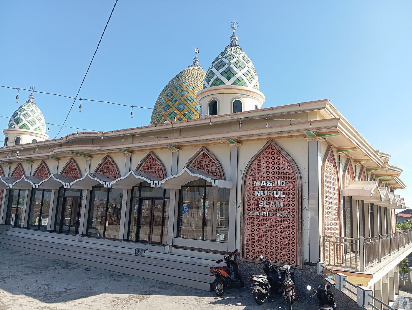
Trade brought settlers. The same account notes a peranakan Chinese community long established in Seririt and a strong part of its economy, along with newcomers from other regions. In Pengastulan village, a study from Ganesha University of Education in Singaraja dates the Masjid Jami' As-Shalihin to 1821, founded by Muslim settlers from Bugis country in Sulawesi, and finds it the oldest mosque in the district, built in the manner of Bugis mosques at home.
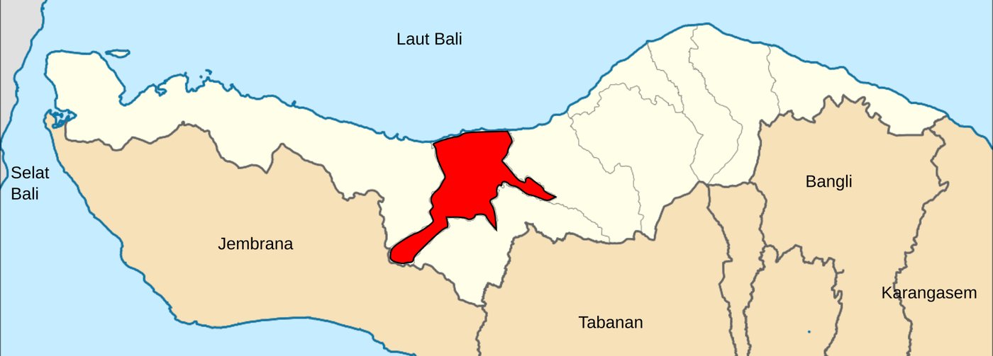 Seririt district in red, reaching inland from the coast between Banjar and Gerokgak districts. Map cropped. Photo: Joseagush / Wikimedia Commons (CC BY-SA 4.0)
What Is in Seririt Town
Pasar Seririt
The traditional market sits in the centre of town on Jalan Ahmad Yani. The regency's tourism directory describes it as selling household needs: food, home furnishings, clothing and more. It is a local market for local shoppers, which is the reason to go. Bring small notes. Map
The Wisnu Murti Statue
In the middle of town stands a seven-metre statue of Wisnu Murti with nine faces and ten arms, consecrated in September 2023. The district office explains the design: Wisnu faces west, and a statue of Dewi Sri, his consort and the town's customary emblem, faces east, the two joining life's energies. It is a landmark more than a sight, and the easiest way to know you are in the centre.
What Is Around It
Umeanyar and Puri Jati Beach
Umeanyar is one of the district's tourism villages, and its draw is Puri Jati, a black-sand beach a few miles west of Lovina. The village listing says it is hard to find unless you know it, that any reputable dive centre in Bali will know it, and that the lane runs through rice fields to a small car park with a restaurant, showers, rinse tanks for dive gear and clean toilets. Map
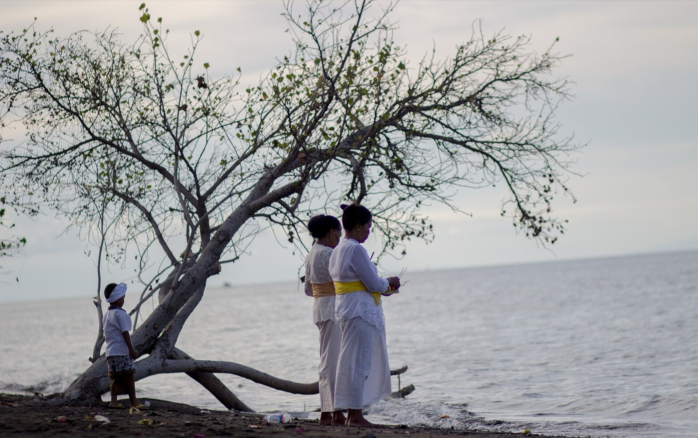 Melasti, the purification before Nyepi, on the beach at Umeanyar. Photo: Aryakori / Wikimedia Commons (CC BY-SA 4.0)
Umeanyar also has the Ayurvedic resort covered in the best spas in north Bali, and one of Palm Living's villas, Villa Banyan, which its listing places on a small cliff 30 metres above the sea and 300 metres from the beach, with five bedrooms.
Lokapaksa Beach
Lokapaksa, the biggest village in the district by area, is working on its beach as a village tourism site. The tourism office's listing describes a quiet stretch with open sea views and sunsets, so far untouched by tourist crowds. Map
Endek Weaving at Kalianget
Weavers in Kalianget make endek mastuli, a silk-based endek that the tourism office says is in demand for its motifs. The listing gives Banjar Dinas Dawan, in Kalianget, as the place. For how endek and songket fit into the north's craft traditions, see traditional crafts of north Bali. Map
Grape Picking at Patemon
The dry north coast grows grapes, and the tourism office lists Wira Grape Sejahtera at Banjar Dinas Uma, Patemon, as a place to pick sweet grapes from dozens of varieties. Official listing · Map
The Titab–Ularan Reservoir
Inland, where Ularan village in Seririt district meets Titab, the Titab–Ularan dam holds back the Saba river. The regency's tourism office calls it the largest dam and reservoir in Bali, built for irrigation, a raw water supply and a small hydropower plant. Its water reaches into six villages in two districts. From Singaraja it is about 30 km, around 55 minutes. Map
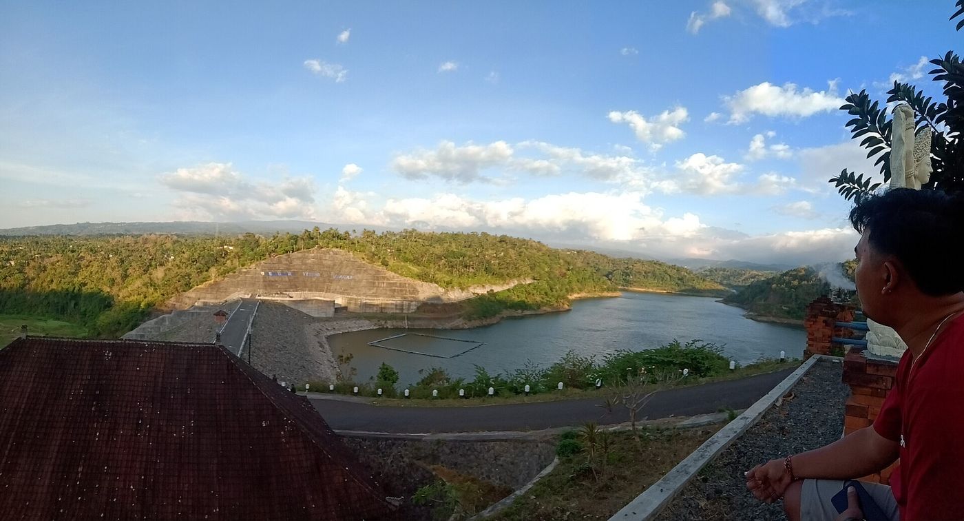 The Titab–Ularan reservoir and dam wall. Photo: Anggabuana / Wikimedia Commons (CC BY-SA 4.0)
Seririt on the Road Map
- The coast road. Going by official distances from Singaraja, Lovina is roughly 11 km east of Seririt and Pemuteran roughly 37 km west, past Pura Pulaki at Banyupoh.
- The Pupuan road. The provincial road from Antosari climbs through Pupuan, both in Tabanan, and comes down to the coast at Seririt. It is the western way over the mountains, and getting to north Bali compares it with the Bedugul road. Heavy rain has closed it with landslides before, so ask about conditions in the wet season.
- East, toward Lovina. The Banjar hot springs, about 5 km south-west of the Lovina coast, and the Brahmavihara-Arama monastery close by are the sights on the way east.
The north Bali map shows all of this at a glance, and Buleleng Regency explained covers Seririt's place among the nine districts.
Practical Notes
- Supplies: Arta Sedana Seririt, listed by the tourism office, is a supermarket and department store at Jalan Ngurah Rai 1. Map
- Hospital: A government general hospital stands on the Seririt to Singaraja road in Tangguwisia village. Map. For the wider picture, see healthcare in north Bali.
- Staying: The nearest beach base is Lovina, about 11 km east. Palm Living's villas are mostly around Lovina, with Villa Banyan inside Seririt district at Umeanyar.
- Dress: Seririt has mosques, temples and a Chinese community side by side. Cover shoulders and knees if you step inside any place of worship; temple etiquette covers the Balinese side.
FAQ
Where is Seririt in Bali? On the north coast of Bali, about 20 km west of Singaraja, in Buleleng Regency. It lies between Lovina to the east and Pemuteran to the west, where the road over the mountains from Pupuan reaches the sea.
Is Seririt worth visiting? As a short stop, yes: the market is a real local one, and the district holds Puri Jati beach, the Kalianget weavers and the Titab–Ularan reservoir. For a base, Lovina and Pemuteran are the usual choices.
What does the name Seririt mean? Nobody knows for sure. The town's lurah has suggested it comes from the English "three street", from the colonial trading days, and the regency reports that as a local belief.
How far is Seririt from Lovina? Roughly 11 km. The tourism office puts Lovina about 9 km west of Singaraja, and the district office puts Seririt about 20 km west.
Is there a beach at Seririt? Within the district, yes. Puri Jati at Umeanyar is a black-sand beach used by dive centres, and Lokapaksa is developing its beach for visitors. For a beach town with restaurants and places to stay, Lovina is the nearest.
Can you drive from Seririt to the south of Bali? Yes. The provincial road south from Seririt climbs through Pupuan to Antosari, both in Tabanan regency. It is the western alternative to the Bedugul road; check conditions after heavy rain.
Sources
- Seririt district office, LKjIP Kecamatan Seririt 2025 (PDF: 20 km from Singaraja, the borders, the area, the twenty villages and one ward), Indonesian, read September 2026
- Seririt district office, Pilosofi Patung Wisnu Murti (the statue's consecration and meaning), Indonesian, read September 2026
- Buleleng Regency government, Jejak Sejarah Seririt (the trading town of 1912, the "three street" story, the peranakan Chinese community), Indonesian, read September 2026
- Ganesha University of Education repository, Sejarah Masjid Jami' As-Shalihin di Desa Pengastulan (the mosque of 1821 and its Bugis founders), Indonesian, read September 2026
- Visit North Bali, the regency tourism directory: Pasar Seririt, Umeanyar Tourism Village, Lokapaksa Tourism Village, Endek Sutra Mastuli Kalianget, Picking Grapes, Arta Sedana Seririt, RSUD Tangguwisia, Banjar Hot Spring and Pulaki Temple, English, read September 2026
- Buleleng tourism office, Sekilas Tentang Bendungan Titab Ularan (largest dam in Bali, the Saba river, six villages in two districts, 30 km and 55 minutes from Singaraja), Sejarah Lovina and Muter-muter Desa Pemuteran (distances from Singaraja), Indonesian, read September 2026
- Kilas Bali, BPBD Tabanan buka jalur Pupuan-Seririt pasca longsor (the Antosari to Seririt provincial road and the January 2026 landslides), Indonesian, read September 2026
- Palm Living, Villa Banyan, Umeanyar, English, read September 2026
Read next: Lovina, eleven kilometres east, Pemuteran to the west, and the complete north Bali travel guide.