On this page
In Brief
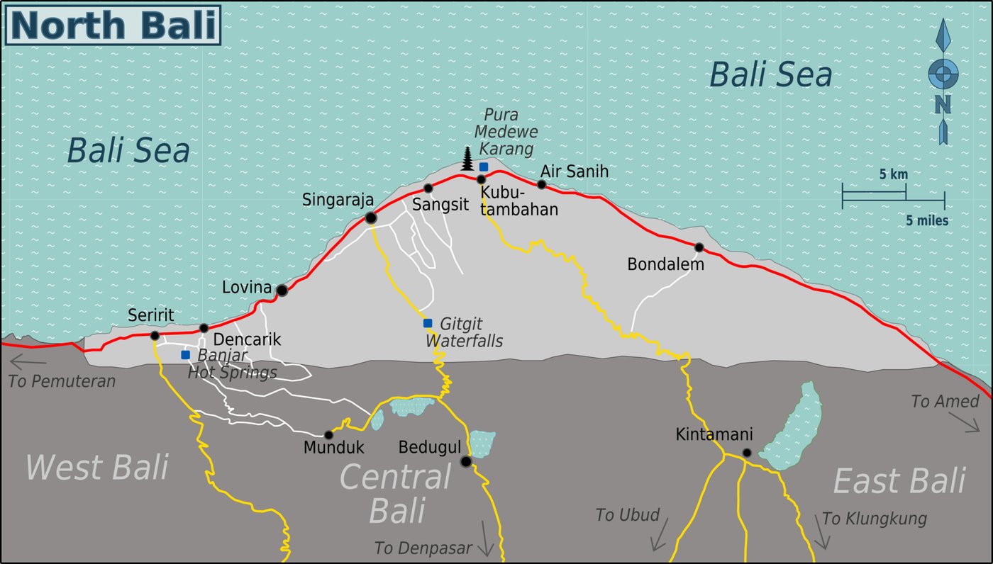
On a map of north Bali, everything hangs off one coast road. From west to east it runs past Menjangan Island and Pemuteran in the far north-west, the market town of Seririt, the Lovina beaches, and Singaraja, the capital, then on through Kubutambahan and Tejakula toward Amed in the north-east corner. Behind Lovina the land climbs to Munduk and the lakes of Buyan and Tamblingan, with Bedugul at the top of the main road from the south. By official figures, Lovina is about 9 km west of Singaraja, Seririt about 20 km, Pemuteran about 57 km, Sekumpul about 20 km inland and Les, in Tejakula, about 35 km east.
North Bali at a Glance
Places run west to east. Distances are from Singaraja, as given by the regency's own offices; "n/a" means no official figure was found.
| Place | Where it sits | From Singaraja | Guide | Map |
|---|---|---|---|---|
| Menjangan Island | Offshore in the far north-west, inside West Bali National Park | n/a | Menjangan | Map |
| Pemuteran | Coast road, Gerokgak district | About 57 km west | Pemuteran | Map |
| Seririt | Coast road, where the Pupuan road comes down | About 20 km west | Seririt | Map |
| Lovina | Central coast, Kalibukbuk | About 9 km west | Lovina | Map |
| Singaraja | Central coast, the capital | n/a | Singaraja | Map |
| Munduk | Highlands above Lovina, Banjar district | About 34 km (to the Munduk waterfall) | Munduk | Map |
| Bedugul | Top of the main road from the south, Tabanan regency | n/a | Bedugul | Map |
| Sekumpul | Inland hills, Sawan district | About 20 km | Sekumpul | Map |
| Tejakula | Coast road east of Singaraja | Les, in Tejakula district, about 35 km east | Tejakula | Map |
| Amed | Round the north-east corner, Karangasem regency | n/a | Amed | Map |
The Shape of the North
North Bali, in the regency's own phrase, is nyegara gunung, sea and mountain. Most of Buleleng is hill country rising to the south, and the towns, rice fields and main road sit on a narrow strip of low ground along the shore.
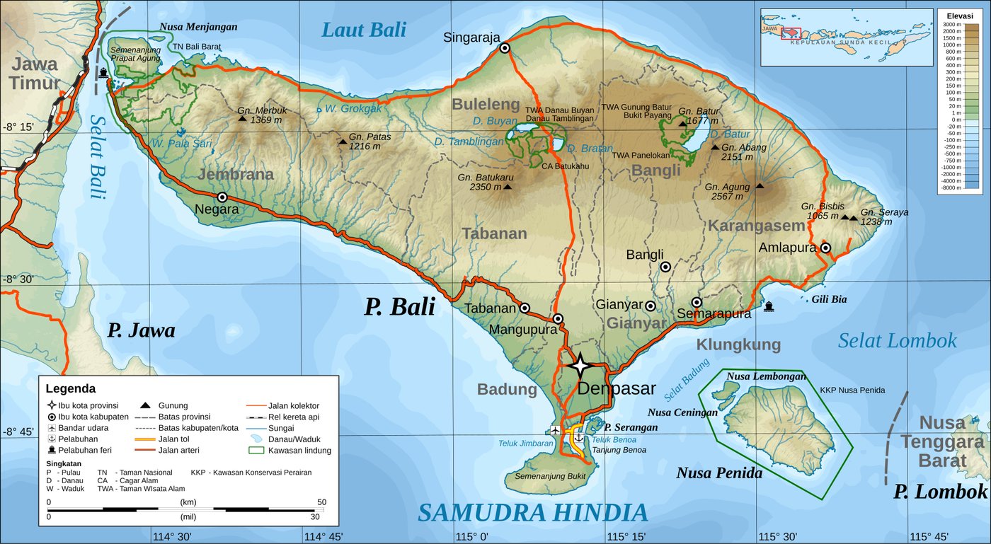 The whole island, with Buleleng along the top, Singaraja on the coast and the lakes of Buyan, Tamblingan and Bratan in the highlands behind. Labels in Indonesian. Photo: RXerself / Wikimedia Commons (public domain)
The whole coast from Menjangan to Tejakula belongs to one regency, Buleleng. Two places often counted as north Bali lie just outside it: Bedugul and Lake Beratan are in Tabanan, and Amed is in Karangasem. The Buleleng Regency guide has the nine districts and what each holds.
West to East Along the Coast
The far west. Menjangan Island lies off the north-west tip, inside West Bali National Park. Along the coast from the park is Pemuteran, in Gerokgak district, about 57 km from Singaraja. On the same road, the sea temple of Pura Pulaki stands at Banyupoh.
Seririt. About 20 km west of Singaraja, Seririt is where the provincial road from Antosari and Pupuan, the western crossing of the mountains, comes down to the coast. Going by the official figures, Pemuteran is roughly 37 km further west and the centre of Lovina roughly 11 km east.
Lovina and the hot springs. Lovina beach is at Kalibukbuk, about 9 km west of Singaraja. The Banjar hot springs are about 5 km south-west of the Lovina coast, up a series of village roads from the main road, with the Brahmavihara-Arama monastery close by.
Singaraja. The capital sits where the main road from the south, by way of Bedugul and Gitgit, reaches the coast. Gitgit waterfall is on that road about 11 km from the city. See Singaraja old town for the city itself.
The east. Past Singaraja, the road runs through Kubutambahan, where Pura Maduwe Karang stands and the Air Sanih spring is at Bukti, then on to Tejakula and Les, about 35 km east of Singaraja. The Tejakula guide covers that stretch. Beyond it the road crosses into Karangasem; Amed is in Abang district there.
Coast to Highlands
The second direction on the map is uphill. Behind Lovina and Singaraja the ground rises to the forest and caldera lakes of the highlands, and the waterfalls sit on the slopes in between.
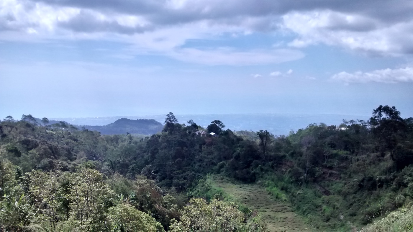 Looking down from the highlands toward the coast. Photo: F-GSPY / Wikimedia Commons (CC BY 3.0)
- Munduk is a village of clove, coffee and cocoa gardens at 600 to 800 metres, according to the regency's tourism office, in Banjar district. Munduk guide.
- Lake Tamblingan lies in the Munduk village area of Banjar district, and Lake Buyan next to it in Sukasada; the tourism office describes Tamblingan as one of three lakes formed in a large caldera. The twin lakes.
- Bedugul and Lake Beratan, the third lake, are across the regency line in Tabanan, at the top of the main road. Bedugul guide.
- The waterfalls: Gitgit and Aling-Aling are in Sukasada district, south of Singaraja; Sekumpul is in Sawan, further east. The north Bali waterfalls guide maps them all.
The highest point in the regency is Gunung Tapak, 1,903 metres, in Sukasada district.
Rough Drive Times
Only times the official pages state are given here. Roads in the hills wind, and rain slows everything.
- Singaraja to Sekumpul: about an hour, per the Sawan district office
- Singaraja to the Munduk waterfall: about an hour, per the tourism office
- Airport to Munduk: about two hours in the Munduk village listing, two and a half in an older tourism office feature
- Airport to Pemuteran: about four hours, 134 km, on the Singaraja to Gilimanuk road, per the Pemuteran village listing
- Denpasar to Sekumpul: about two and a half hours, 76 km, per the tourism office
For the airport run to Lovina and the three mountain crossings, see getting to north Bali; for day trips, private drivers in north Bali.
Practical Notes
- Choosing a base: Lovina sits in the middle of the coast, so the far west and the east are both day trips from it. Palm Living's villas are mostly around Lovina.
- Official addresses: The regency's tourism directory, Visit North Bali, gives the village and district for each attraction, useful when a map pin looks wrong.
- Reading addresses: "Kec." means district and "Kab." means regency, so "Kec. Banjar, Kab. Buleleng" is Banjar district in Buleleng.
FAQ
Where is Lovina on a map of Bali? On the north coast, about 9 km west of Singaraja, at Kalibukbuk village. It is roughly in the middle of Buleleng's coastline, facing the Bali Sea, with the highlands of Munduk behind it.
How far is Pemuteran from Lovina? By the tourism office's figures, Pemuteran is about 57 km from Singaraja and Lovina about 9 km, which puts Pemuteran roughly 48 km west of Lovina along the coast road, through Seririt.
Is Munduk near Lovina? Munduk is in the highlands above Lovina, in Banjar district, about 34 km and an hour from Singaraja by the tourism office's figures. It works as a day trip from the coast, or as a cool place to stay a night or two.
Is Bedugul in north Bali? Bedugul is at the top of the main road from the south, in Tabanan regency, so it sits just outside Buleleng. The road north from it passes Gitgit and comes down to the coast at Singaraja.
Is Amed in north Bali? Amed is in Abang district of Karangasem, round the north-east corner of the island. The coast road from Tejakula carries on into Karangasem, so a trip along the whole north coast can end there.
Where is Seririt? On the coast about 20 km west of Singaraja, between Lovina and Pemuteran, where the road over the mountains from Pupuan reaches the sea.
Sources
- North Bali region map, Wikimedia Commons (Burmesedays, Peterfitzgerald and OpenStreetMap contributors, CC BY-SA 3.0), read September 2026
- Buleleng Regency government, Geografis dan Iklim (Gunung Tapak, the lakes and their districts), Indonesian, read September 2026
- Buleleng research and innovation agency, Selayang Pandang Kabupaten Buleleng (nyegara gunung, hills to the south and the coastal strip), Indonesian, read September 2026
- Buleleng tourism office, Sejarah Lovina (Lovina about 9 km west of Singaraja), Muter-muter Desa Pemuteran (Pemuteran about 57 km from Singaraja), Air Terjun Sekumpul (76 km and about 2.5 hours from Denpasar), Air Terjun Munduk (34 km and about an hour from Singaraja) and Menikmati Hening dan Sejuk Desa Munduk (Munduk's altitude and gardens, about 2.5 hours from the airport), Indonesian, read September 2026
- Seririt district office, LKjIP Kecamatan Seririt 2025 (PDF: Seririt 20 km west of Singaraja), Indonesian, read September 2026
- Sawan district office, Air Terjun Sekumpul (20 km and about an hour from Singaraja), Indonesian, read September 2026
- Tejakula district office, Sejarah Desa Les (Les about 35 km east of Singaraja), Indonesian, read September 2026
- Visit North Bali, the regency tourism directory: Lovina Beach, Banjar Hot Spring, Gitgit Waterfall, Tamblingan Lake, Munduk Tourism Village, Pemuteran Tourism Village, Pulaki Temple, Air Sanih, Aling-Aling Waterfall and Snorkeling Menjangan, English, read September 2026
- Kilas Bali, BPBD Tabanan buka jalur Pupuan-Seririt pasca longsor (the Antosari to Seririt provincial road through Pupuan), Indonesian, read September 2026
- Bali provincial government, Love Bali, Ulun Danu Beratan (Lake Beratan at Candikuning, Tabanan), read September 2026
- Karangasem tourism office, Kecamatan Abang (Amed in Abang district), Indonesian, read September 2026
Read next: Buleleng Regency explained for the districts, the complete north Bali travel guide for planning a trip, and things to do in north Bali once you know where everything is.